Chalkida
Sanctuary of Artemis at Aulis
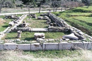
It is located between Avlida and Chalkida. Aulis or “Avlida” as it’s known in Greek was where one of the most dramatic scenes throughout Homer’s Iliad took place. After killing a sacred deer of the Goddess Artemis, the leader of the Greek forces Agamemnon could not set sail for Troy due to a lack of wind. The space has revealed at Aulis is the place of worship of Artemis which is the temple of the goddess. Phase edge of the sanctuary lasted from the Classical to the Roman period.
The area was inhabited since Mycenaean times ( 16th-12th century BC), The Homeric Aulis but believed that further north, in Glyfa near Halkida. The continuous use of space certifies finding portion arched building of the Geometric period ( 10th-8th century BC.) beneath the Temple of Artemis in the 5th century BC. At the same time made the Sacred Fountain located 8μ east of the church and surrounded by precinct. In the Hellenistic period ( 330-30 BC ) added a vestibule to the temple and built a complex of laboratories and hostel south. In imperial times (30BC – 330 AD ), the church repaired, while the number of offerings shows the bloom of worship. The temple was destroyed during the invasions of the Goths of Alaric in 396 AD Later, in the place of the church founded baths (thermae) .
Aulis was never a town and considered part of the province of Thebes until 387 BC. Since then it belonged territorially to Tanagra. The Spartan king Agesilaus, as ” new ”Agamemnon, sacrificed at the shrine of Artemis Avlideias, before embarking to Asia in 397 BC. There is therefore a continuous habitation from Mycenaean to Roman times. Aulis managed to survive mainly due to the existence of the sanctuary of Artemis and ceramic workshops. Report the sanctuary of Artemis is Avlideias Strabo ( 9,2,8 ) and Pausanias ( 9,19,6 ff. ).
Manika, North of Halkida Exo Panagitsa
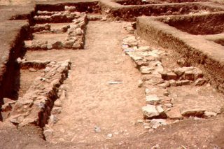
This is an important prehistoric settlement and cemetery of the Early Bronze Age (3000-1900 BC ) which is located in a fertile and strategic point of the Evian Gulf, near Chalkida. It is undeniable that the settlement of Manika was an entire city though not as densely structured, after it was found that there were excavated and uncovered several areas. The heyday of the settlement must be that controlled the main sea route communication era, the Evian Gulf, while handled and processed, obsidian and especially metals, which ought and the greatest growth. From J. Davis was caracterized as one of the largest settlements of the Bronze Age in Greece, but if one looks deeper, one finds that to date has not been found in other larger extent. Is also without disputing that the city had a urban plan, because the most places found with orientation of houses addressing NS or EW. This approach seems to have been influenced by natural axes, the coast and the ancient road that went along the direction N.S. The first traces of habitation was encountered since the Paleolithic period, but the first major settlement can be termed as hamlet took place around 3000 BC at the beginning of the Neolithic Period. This first center of town was the northern edge of the current in the sleeves. This first city would live for a millennium and as revealed by archaeological excavations was a well organized city with large blocks, roads and houses that were square or arched ground floor or first floor, and had also a sacred focus, wells and pebbled floors. In the course of other settlements developed around this seems to indicate the overall edge presented with permanent habitation and so acquires its first competitors.
The Hellenistic cemetery of Agios Stefanos.
A large cemetery from Hellenistic Chalkida has been unearthed along the ancient road that led to Eretria. It includes tombstones and ancient steps leading up to the top, towards the ancient Acropolis of Chalkida.
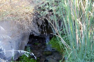
The Fountain of Arethusa at the southern entrance of Halkida, in Agios Stefanos.
Eretria
Eretria, «the city of rowers» (whose name originates from the verb Eretto, meaning to row) is located on the lush plains southwest of Chalkida, opposite Oropos in Attica. Eretria was once an important naval city of Greece, since the 8th century BC and had numerous colonies along the coasts of the Aegean, the islands, and Greater Greece.
Archaeological artefacts from the Mycenaean era demonstrate the high quality of life enjoyed by its residents, a fact further attested by the inclusion of its residents in Homer’s catalogue of ships.
Eretria began to develop its urban character from the 8th century BC. It took part in the Greek colonial effort, founding a number of colonies, and developed into an important commercial centre, with ties to the eastern Mediterranean.
The expansion of Eretria troubled Chalkida, and led the two cities to the well-known war of Lilandio. Despite the negative outcome of the war, Eretria continued to flourish during the archaic period. In 494 BC, it supported Militos in its revolt against the Persians, a move that led to its destruction four years later, in 490 BC Notable residents of Eretria include the painter Filoksenos, who created a painting of the battle of lssos, the tragic poet Achaios, and the philosopher Menedimos, founder of the School of Eretria. The Romans destroyed the city, which was abandoned and slowly fell into ruin.
The Archaeological Museum of Eretria. Notable among its exhibits are the sculptures from the temple of Dafniforos Apollo (the laurel bearer), and especially that ofThiseas and Antiopi.
The Ancient Theatre of Eretria.
The Eretria Dome.
The Macedonian Tomb of Eroton.
The temple of Dafniforos Apollo in Eretria.
The Baths of Limani, 3rd century BC.
Lower Gymnasium baths in the southeastern part of the city, 4th century B.C.
Archaeological site North of the Museum: Western Gate early archaic period, Sanctuary of Ares, 2nd century BC., Anaktoro 5th century BC., Temple of Dionysos 4th century BC., Upper Gymnasium, 4th century BC., Thesmoforio (sanctuary of Dimitra) 3rd century BC.
Macedonian type Tomb in Kotroni
Early Christian Basilica in Agia Kyriaki, 3 Km SE of the cities.
Central Evia
Lefkanti is located between Chalkida and Eretria. Archaeological expeditions in ancient Kseropoli brought to light important information about the so-called Dark Years.
The Monument of Toumba, Lefkanti, is the largest monument from the Early Iron Age to be discovered in Greece.
In the settlement of Xeropolis have seen a successive building phases, of which the oldest dates back to the Early Bronze Age.
At Touba hill, findings of a vaulted building, this is about 47m long and 10m wide. This is the familiar Memorial bleach, which was constructed probably in the first half of the 10th century BC this is the most monumental structure of the Early Iron Age, which has been discovered in the world. The building had wooden outer colonnade. Inside, the main room, were found two burials hegemonic character, a man and a woman, accompanied by rich grave goods, some of which were imported from the East, and horse burials. This structure is interpreted as a house – ruler of a local government, which after his death turned into a memorial and was covered by mound.
The adjacent hills have uncovered the cemeteries of the town, whose research yielded significant number of burials (179 graves and 93 cremations). The cemeteries of the Early Iron Age yielded rich finds, gold jewelry and luxury goods from the East. Archaeological research has shown that the tombs belonged to a community with a high standard of living. The richest burials belonged to warriors buried with their weapons and valuables coming from the East. The guns were usually made of iron, as this new technology had reached the Aegean probably from Cyprus around 1000 BC. Gold jewelry was placed in female burials of which there were missing earrings and rings. Among the imported objects held was a special place of vases of faience and copper.
In the region of Halkida in Anthidona lies the Tomb of Salganea.
The wetland of Psachna, otherwise, said, the Kolovrechtis, a coastal wetland created by a small river at the beginning of the valley looking at central Evia, which flows into the North Evian. Located 12 km north of Halkida, the Kolovrechtis Wetlands should be famed for the natural utopia it provides to hundreds of different plant and animal species.
Amarynthos the natural harbor in the southern Gulf of Evia inhabited throughout the prehistoric and classical times until the Roman period ( 3000 BC – 1st century AD ).
The name of Amarinthos mentioned in Linear B tablets.
Points of interest in the surrounding area of Amarynthos are:
Paleochora, evidence of Neolithic human activity.
Macedonian tomb facade typousto way for Upper deeply.
Roman Baths of Aliveri. The ancient baths, discovered on site steam electric plants in the Karavos Aliveriou, an interesting monument of the late Roman period.
Mycenaean tomb at Katakalou. It is the best preserved Mycenaean tholos tomb in Evia. Located about two kilometers north of the village.
La Cuppa castle this small fortification built with large stone slabs sits at the entrance of the Manikiatis Gorge just above the small hamlet of Vrysi. Researchers have also discovered ruins at this site which date back to the Hellenistic period.
Skoteini Thourrounion Cave. One of the most intriguing caves throughout Evia is the cave of Skoteini outside of the village of Thourrounia in the middle of central Evia dated to the Early Neolithic period. Near the cave was excavated Neolithic settlement and cemetery.
Viglatouri Oxylithos. In the region of modern Kymi Viglatouri Oxylithos the hill, three kilometers from the sea, have uncovered the remains of ancient Kymi.
Viglatouri – ancient Kymi The ancient city has been discovered in Viglatouri Kimi archaeologist and excavator Effie Sapouna – Sakellaraki, which coincides with ancient Kymi that is probably the home of the Latin alphabet. Archaeological finds suggest that the idiotypes ” chalcidicum ‘ alphabet, in which S is written as C, the D as D, the X as X , R to R and Y as U, extracted from Euboeans settlers in Italy later to become the Latin alphabet.
Effie Sanouna – Sakellaraki had published in 1984 an article in the Archaeology newspaper, which claimed that indeed the ancient Greek city – Kymi was mentioned by ancient writers as the Italian metropolis of Kymi – despite the scientific controversy, as until then there had been no corresponding archaeological findings.
Description:
The archaeological site of Kymi is located 3 km from the sea, on the hill of Viglatouri. This revealed an entire village of prehistoric and Geometric period with houses, temples, squares, streets and tombs. The ruins that are visible cover the slopes of the hill, belonging mainly to the settlement of the Geometric period, whose scope is not yet seen as a whole.
Has revealed rectangular and arched buildings with paved roads, constructed of small stones, pebbles, pressed shells and a small section of the wall at the foot of the hill. In the central nucleus of the settlement was square and an oval stone building, sanctuary , found looted and given rich pottery , which dates back dated to the mid-8th century BC. The arch was the first that came to light during the excavations of 1984. This building can be interpreted as a shrine – memorial, according to the opinion of the archaeologist Effie Sapouna – Sakellaraki. Corresponding examples of oval buildings from this period are known from Euboea (in Lefkanti where they celebrate religious festivals in honor of the dead), but outside of Evia, Smyrna and lift. The hypothesis for the function of the building is strengthened by the existence of the adjacent paved area, which was founded on Protogeometric graves. To the east of free paved area revealed one Rockrose many animal bones, which was probably a kind of grid, where the sacrifices were made. The shape of the altar is known in the East but also in the Cyclades. The sanctuary, which according to the pottery found there, flourished from the mid-8th century BC and destroyed around 700 BC is considered to have served as a place of worship nobles, who traveled and lost away from home.
Beneath the ruins of geometric settlement preserved remains a significantly older residential phase, arriving to the. From the settlement of the prehistoric era buildings stand out with craft facilities ( kilns in the Middle Helladic period) and the so-called ” mansion ” of the Mycenaean period, under the later monument .
Kastri Potamias. The ruin of an important settlement of the Classical and Hellenistic period lies on the Kastri hill, north of the village Potamia, in Evia. Surface finds from the southern slopes of the hill indicate that the site was inhabited from the Neolithic period (fourth millennium BC) and onwards.
Archampolis in Kafirea, between the villages Thymi and Evaggelismos is the ravine Charchampolis or Archampolis gorge, an impressive but rugged landscape. The archaeological site of the ruins Archampolis organized the ensemble, which includes houses, workshops metallurgy, roads and fortifications. The ancient remains have been found in various locations in the nearby ravine or Charchampolis or Archampolis in Kafirea.
The Castle of Fylagra located 4 kilometres north of the village of Giannitsi lay the ruins of this castle which offers its visitors incredible views over the plains below as well as the Aegean to the east.,
In Styra there is an interesting hiking trail that leads to the Ancient Quarries Stone Styria. At the top of the hill overlooks Styra is visited the shamblesCyclopean Wall, where the Megalithic Portal Armenia.
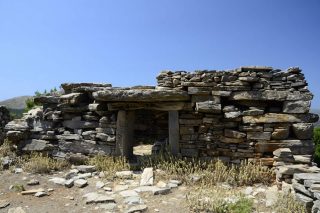
Widely known ancient monuments in Karystia are the Drakospita. They are a group of twenty monumental stone constructions, mostly square or rectangular. The best preserved dragon houses are on the top of Mount Ochi a complex of three Drakospita in place Palli – Lakka in Styra. Other Drakospita identified in the mountainous areas around Styra (positions Limiko , Ilkizes , Kourthea, amines ), but lower in Niborio ( Tower Niborio ) in position vigkla in Poplar Nea Styra and elsewhere. The building is a typical Niborio Hellenistic tower and associated with adjacent quarries. Two Drakospita have also been identified in Central Evia, in term and near Dirfys Vatontas New Artakis.
The dragon houses of Evia then, some of which are still in excellent condition, are human constructions, the products of people who lived on the island before the 7th century B.C. and used them either as temples or as their house.
Common features are the supervisory position in which they were built, the construction of megalithic masonry details and entry and especially the way their housing in ekforic system: big heavy slate layers converge on two opposite walls. The plates each layer protrudes slightly more from the immediately below, so as to achieve the creation of a gable roof. The dimensions of drakospita ranging from about 5 to 13 m
The locals call Dragan or Dragko referred entirely to the way the structure with grayish limestone, usually of large dimensions, built with courage and knowledge.
Dystos In imposing, rocky and steep conical hill castle which dominates the valley near Lake Dystos and is established in antiquity the homonym settlement. The archaeological site Dystos still dominates the imposing walls of the ancient city. In the eastern part of the wall dominates the unique gate flanked by two towers, typical sample fortification technique of classical times.
The Venetian Tower Koutoumoula is a well -preserved medieval tower in a prominent spot outside the village of Koutoumoula. Travellers have the opportunity to see one of the best well preserved Venetian towers throughout the country.
North Evia
Artemis Proseoa sanctuary. One of the most important sanctuaries of Evia, which is related to the famous naval battle between the Greeks and the Persians in 480 BC, is located on the northern tip of Euboea, opposite Mount Pelion on the road leading from the villages Istiaia Artemisi and Halkida. An inscription is found in the temple that dates back to the 4th or 3rd century BC refers to the pyrrhic dance. The goddess Artemis named Agrotera honor of the Pyrrhic dance. It’s possible the dance to be performed by young people in the region to commemorate the battle and thus worship the goddess.
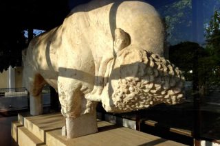
A marble figure, larger than a life statue of a bull and measuring (length: 3.28m preserved height: 1.30m) belonging to a funerary monument of the 4th century B.C. The animal is represented standing, with head bent, in an attacking position. The lower part of the legs, below the knees, and the horns are missing. The statue was raised from the sea in the harbour of Oreoi, in 1965.
The Archaeological Collection of Aedipsos. Housed in the hydrotherapy centre of the Greek National Tourism Organisation the visitor has the opportunity to gaze at an archaeological collection comprising finds from the excavations that took place in the area. Pottery, coins, inscribed pedestals of statues and reliefs derived from rescue excavations in the city. The exhibits are mostly related to the spa during the Hellenistic and Roman period.
- Aydipsos thermal springs
- Roman Valaneiastin beach Gialtra.
- The ruins of the ancient citadel Oreos ( visible parts of the wall )
- Byzantine and medieval castle of Oreoi
- Tower Drosini Gouves.
- Ancient Fortification Kirinthos.
Archaeological sites in Skyros
The ancient Acropolis, is located on the top of the mountain country. During Byzantine times was turned into a Castle, where there exists ancient walls and ruins of the Byzantine and Venetian fortifications.
Mooring Skyros. The settlement at Mooring, the northeastern part of the island, datable between the 3rd and 2nd millennium BC. It is walled with a clear development plan, roads and pipelines and presents important elements organized habitation ovens, hotplates, benches etc.
Palamari Skyrou Located in the North-Eastern part of the island, the ancient settlement of Palamari, is a very important prehistoric settlement. It dates between 2500 and 1800 BC. It displays a clear city-plan with fortification walls and bastions, roads and drain-pipes, organized households with ovens, hearths, stone walls etc. On the coastline of the settlement the remains of a port have been discovered while within the settlement and the surrounding area they found many stones, bones and metal tools and utensils, as well as pottery are exhibited in the Archaeological Museum of Skyros.
Magazia of Skyros. An extensive cemetery of cist-graves dated in the early Iron Age (1000-600 BC).
In the same area, a short distance to the south, The Mycenaean chamber tombs cut into the rock (are dated to 1600-1100 B.C) and graves of the Early Helladic period (3rd millenium BC) have also been discovered.
